Details
Views:
744
Tags
Data Info
Author
FRIEDRICH CHRISTIAN BøTTGER
City
Copenhagen
Country
Denmark
Year
1873
Program
Residential neighbourhood
Technical Info
Site area
72000 sqm
Gfa
0
sqm
Density
1 far
Population density
0
inh/ha
Home Units:
0
Jobs
0
Streetsroad:
0
%
Buildup:
0
%
NonBuild-up:
0 %
Residential
0 %
Business
0
%
Commercial
0
%
Civic
0
%
Description
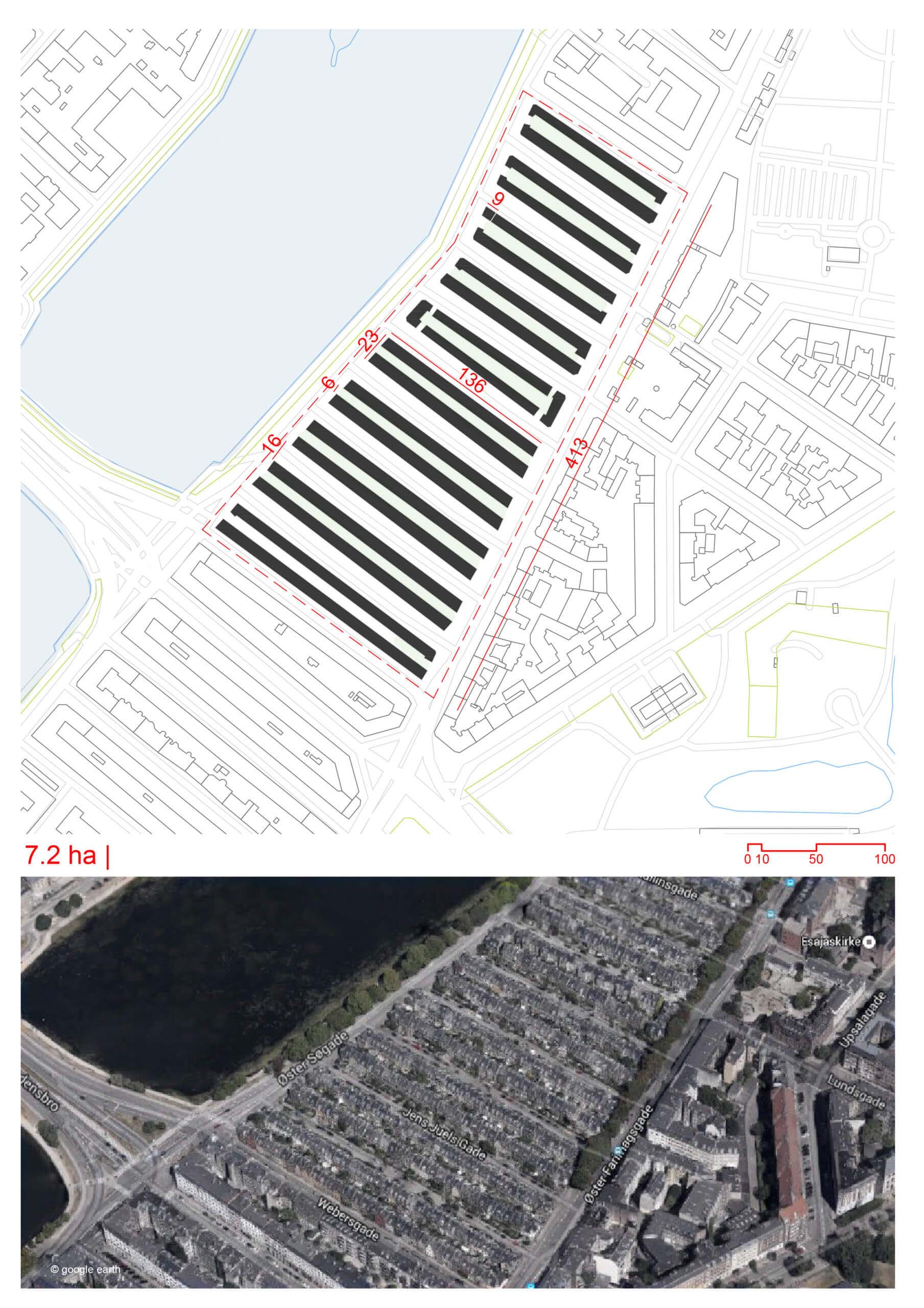
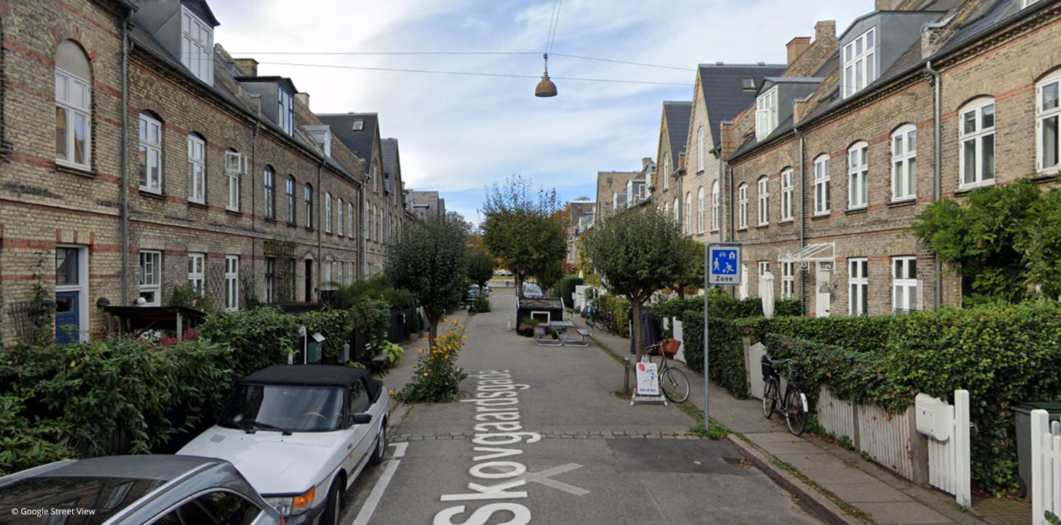
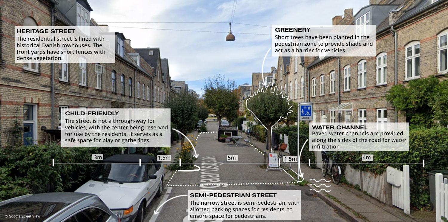
- Built in 1873, Kartoffelrækkerne was modeled after English garden cities and designed by architect Friedrich Christian Bøttger.
- The houses were constructed as public housing by the Workers Construction Association (Arbejdernes Byggeforening), initiated by workers from Burmeister & Wain.
- The development is situated in a central location near Svanemøllen Station, with easy access to public transit, walking, and cycling routes.
- The layout was named the Most Livable Neighborhood in the World by various planning organizations due to its human-centered design and social integration.
- The term "Kartoffelrækkerne" means "potato rows," as the area was built on former potato fields, and the layout of the streets resembles rows of potatoes.
- The neighborhood consists of two- to three-storey townhouses with private gardens.
- Front gardens are designed with landscaping and short fences that buffer residents from street activities while maintaining a visual connection to the street, promoting community interaction.
- Historically, each home housed two families of about 12 people across three floors.
- The homes are narrow.
- The homes hold landmark status, meaning homeowners can alter internal layouts but cannot add volume to preserve the historic and architectural integrity.
- Streets are designed to prioritize people over cars, with street furniture, play structures, and landscaping (such as trees and planting beds) placed in the middle section on the streets themselves.
- Cars are allowed, but they must move slowly due to narrow roads, varied paving surfaces, and obstacles such as trees or street furniture.
- Bicycles are a primary mode of transport.
- At the middle of most blocks, a feature like a tree or picnic tables creates a gathering space, turning the street into a communal "outdoor living room."
- Streets feature no curbs, but instead, have paver-lined gutters or runnels on either side.
Urban Design and Masterplan
Housing Layout and Architecture
Streetscape and Community Design
Location
Deep Dive
Explore a dynamic and data-rich visualization of this masterplan through an embedded Aino.World interactive map. This feature provides a detailed spatial representation of the development, with color-coded information layers highlighting: Buildings – categorized by function and usage ; Green Areas – parks, public spaces, and ecological zones; Points of Interest (POI) – key landmarks, amenities, and services. This map allows users to navigate through the masterplan intuitively, gaining insights into the urban fabric, land use distribution, and connectivity of the area. Dive into the details and analyze how different elements interact within the cityscape.
Streetscapes
Explore the streetscapes related to this project
|
Sources
Explore more Masterplans
|